a
b
c
d
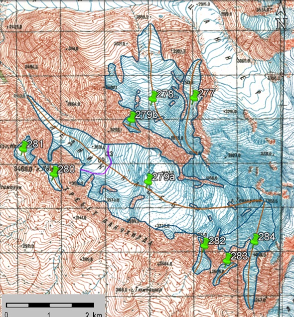
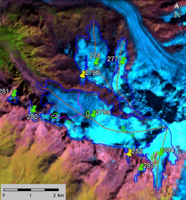
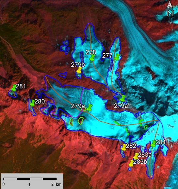
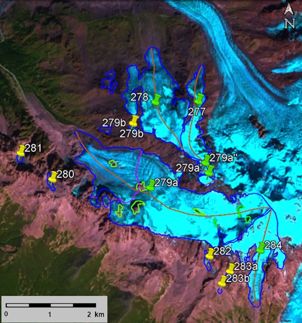
Fig. 41. Contours of glaciers No. 277 − 279 (Nageba), No. 280 − 283 (Tubmashari) and No. 284 (Lakhvashi): a − according to the topographic map, b − according to the Landsat 5 TM sensor image of September 19, 2011, c − according to the Landsat 8 OLI TIRS sensor image of September 12, 2017, d − according to the Landsat 8 OLI TIRS sensor image of September 4, 2020.