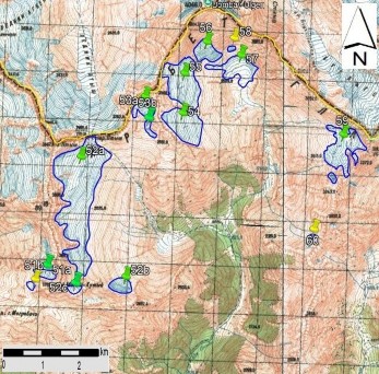
a
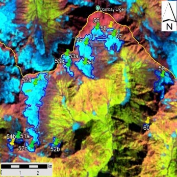
b
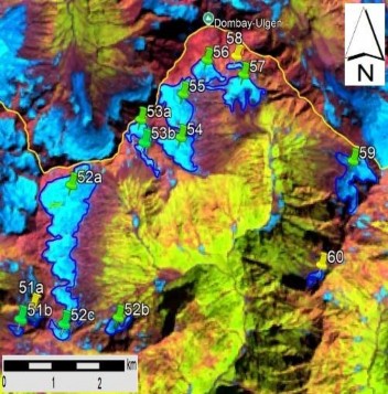
c
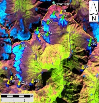
d
Fig. 9. No. 51, No. 52 (Southern Ptishi) − 60 Glacier contours: a − on a topographic map, b − according to the Landsat 7 ETM+ sensor image of August 31, 2010, c − according to the Landsat 8 OLI sensor image of August 28, 2015, d − according to the Landsat 8 OLI TIRS sensor image of September 11, 2020.