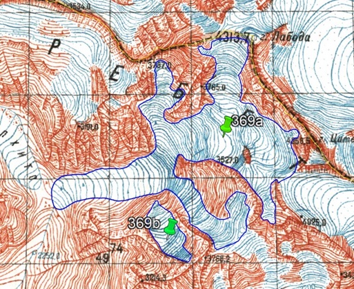
a
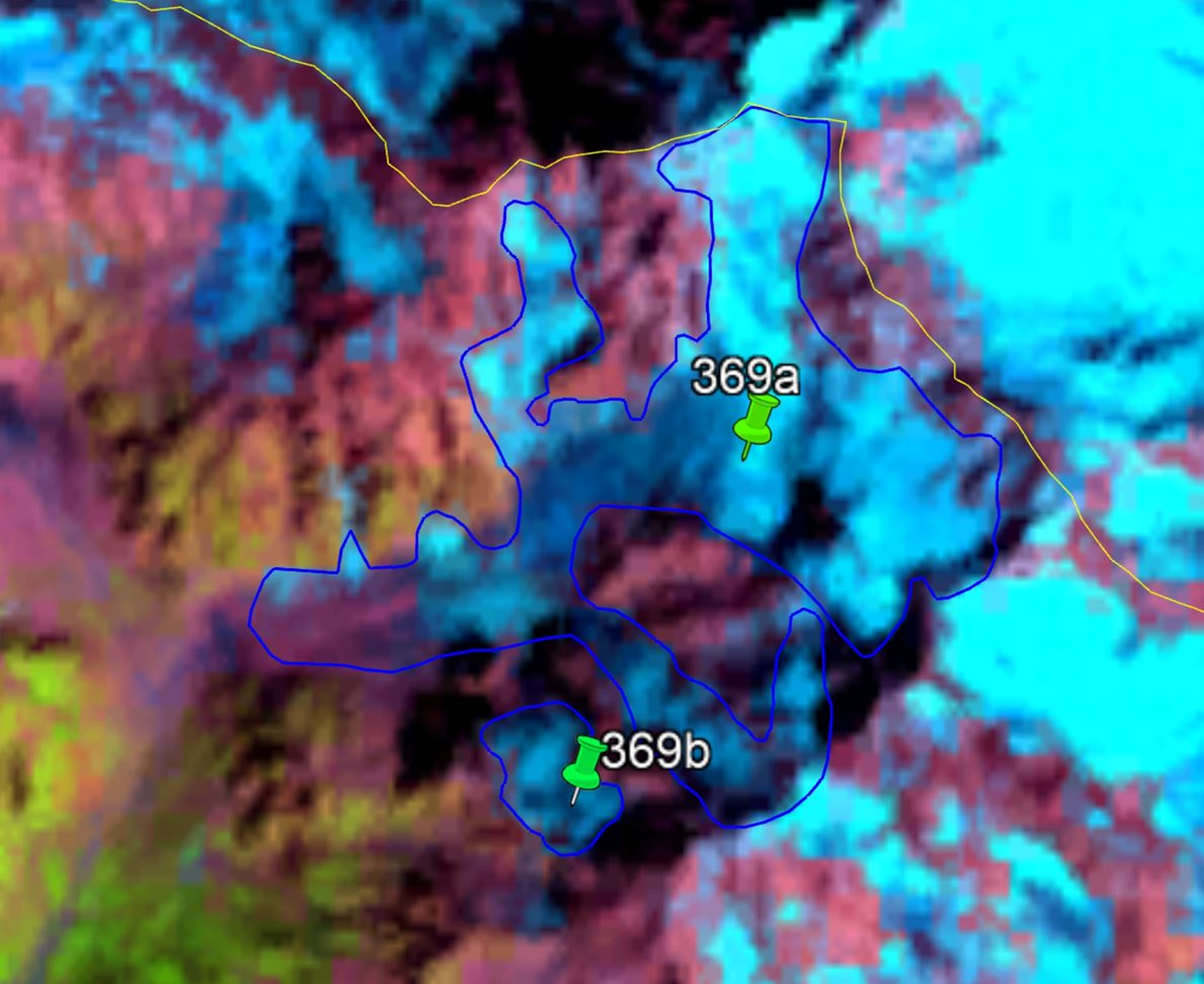
b
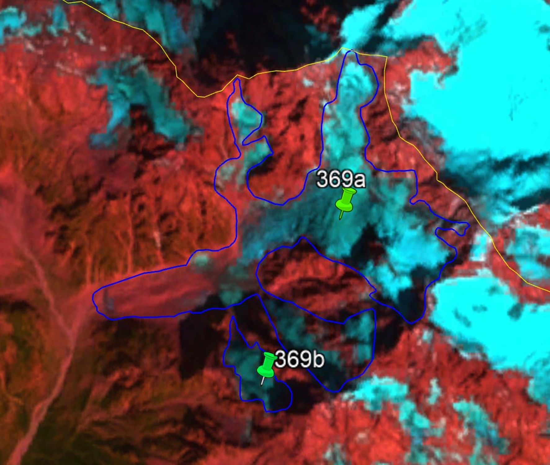
c
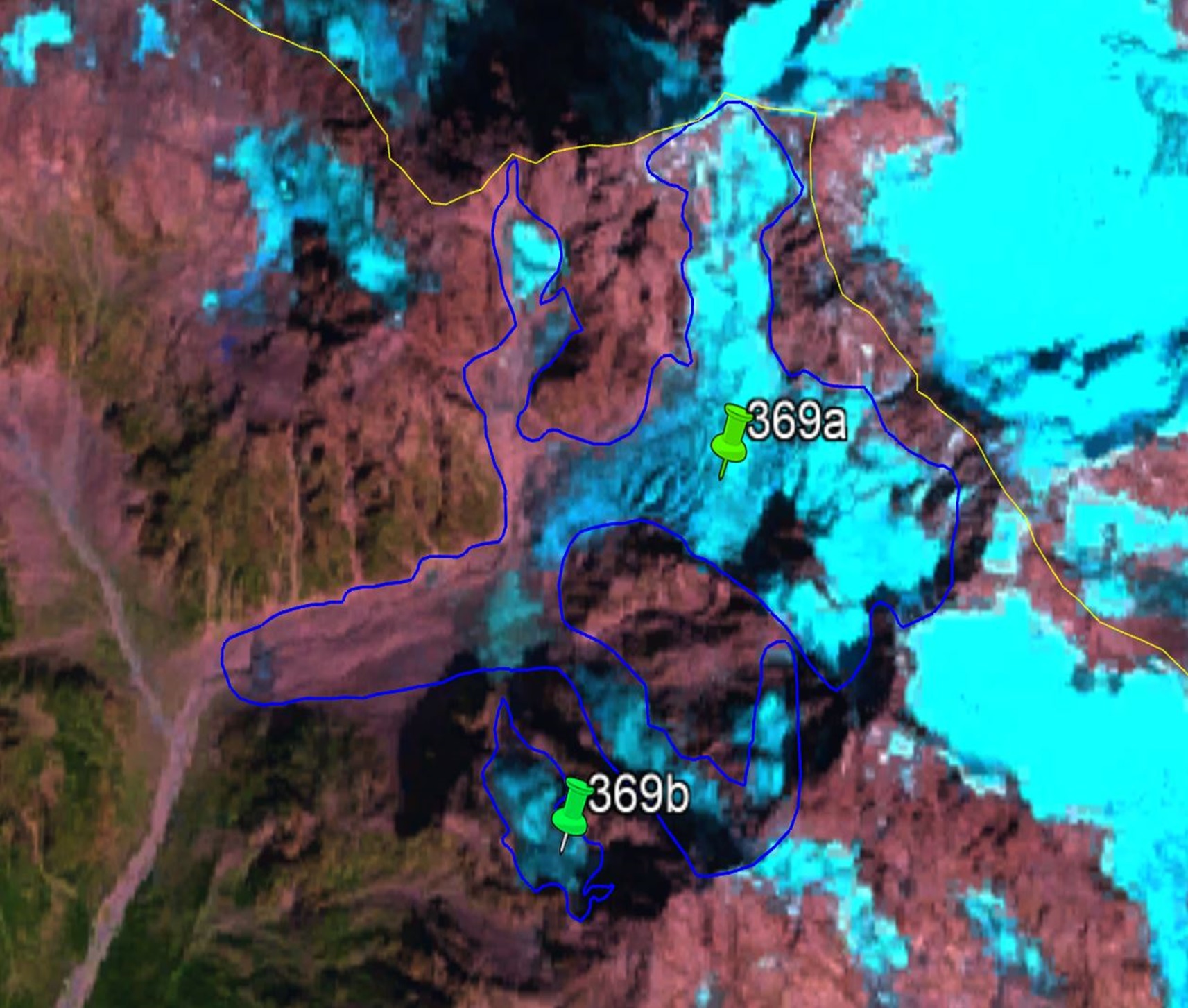
d
Fig. 14. Contours of the glacier No. 369 (Laboda): a − according to the topographic map, b − according to the Landsat 7 ETM+ sensor image of August 31, 2010, c − according to the Landsat 8 OLI TIRS sensor image of September 5, 2015, d − according to the Landsat 8 OLI TIRS sensor image of September 11, 2020.