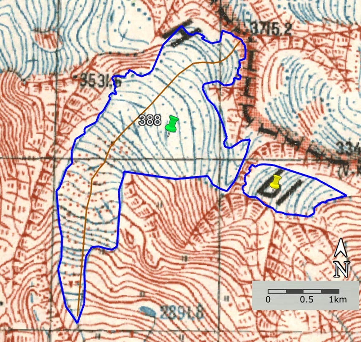
a
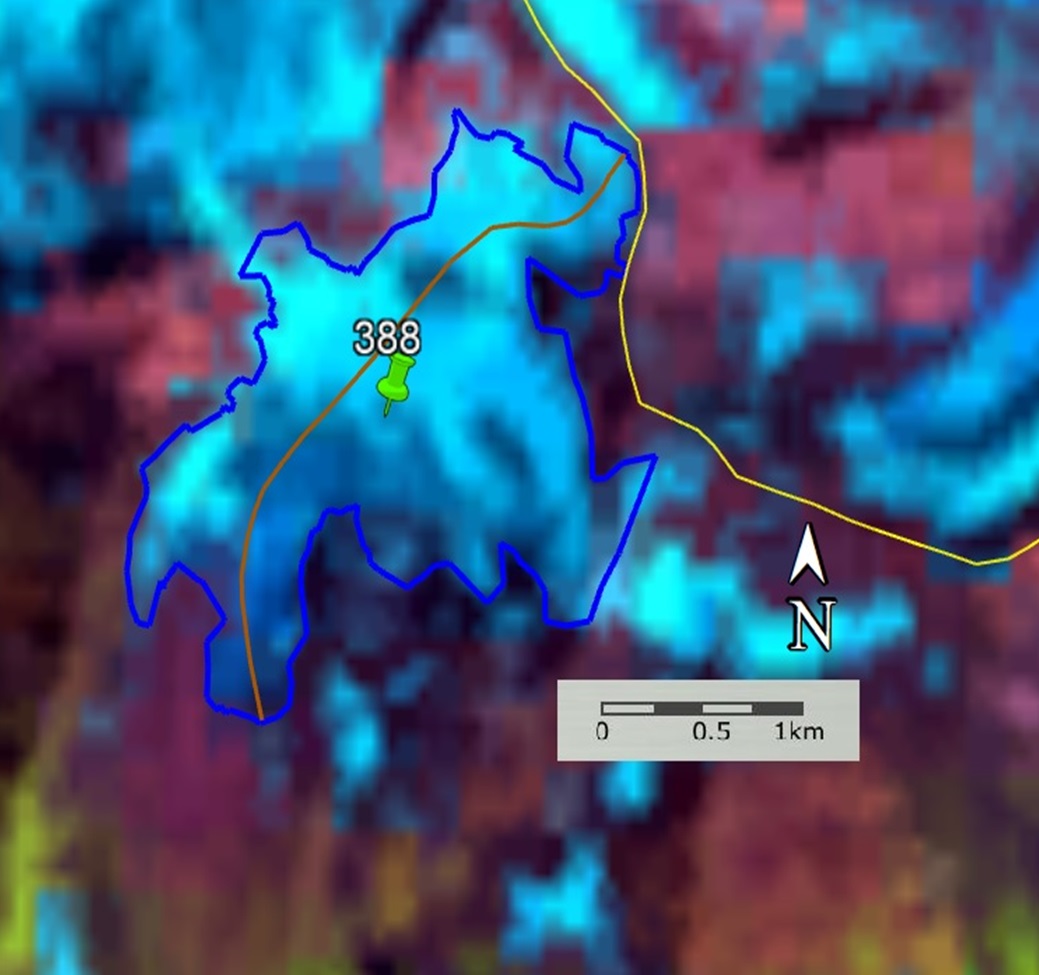
b
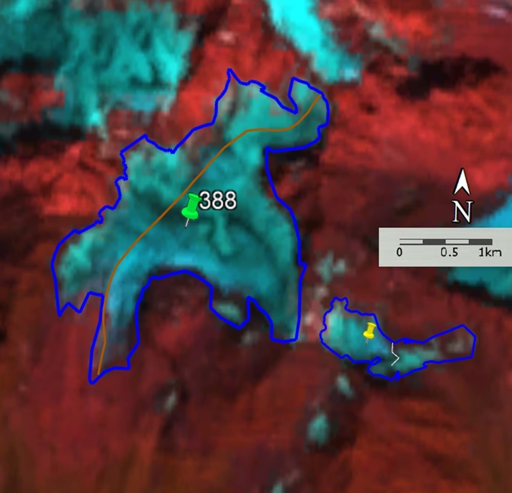
c
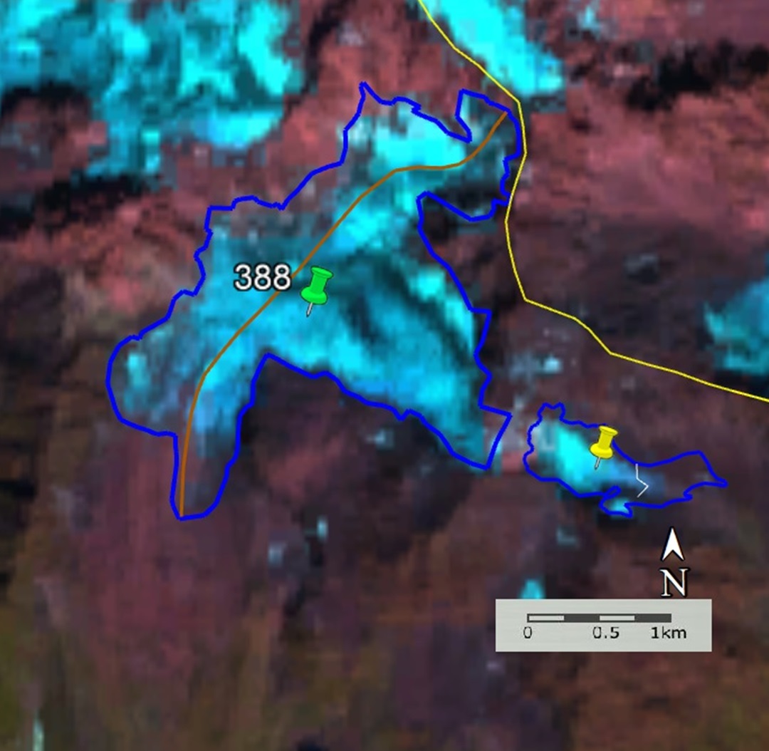
d
Fig. 21. Contours of Glacier Basin No. 388 and the unrecorded glaciers: a − according to the topographic map, b − according to the Landsat 7 ETM+ sensor image of August 11, 2011, c − according to the Landsat 8 OLI sensor image of September 12, 2017, d − according to the Landsat 8 OLI TIRS sensor image of September 4, 2020.